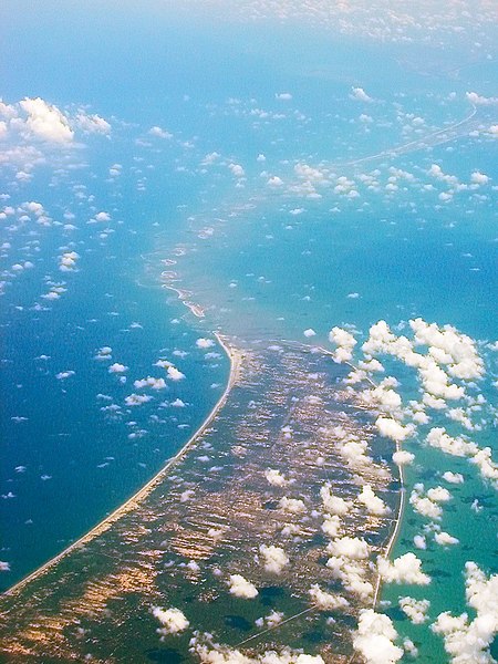
Adam's Bridge (Tamil: ஆதாம் பாலம் ātām pālam), also known as Rama's Bridge or Rama Setu (Tamil: இராமர் பாலம் Irāmar pālam, Sanskrit: रामसेतु, rāmasetu),[1] is a chain of limestone shoals, between Pamban Island, also known as Rameswaram Island, off the southeastern coast of Tamil Nadu, India, and Mannar Island, off the northwestern coast of Sri Lanka. Geological evidence suggests that this bridge is a former land connection between India and Sri Lanka.[2]
The bridge is 18 miles (30 km) long[3] and separates the Gulf of Mannar (southwest) from the Palk Strait (northeast). Some of the sandbanks are dry and the sea in the area is very shallow, being only 3 ft to 30 ft (1 m to 10 m) deep in places, which hinders navigation.[2][4][5] It was reportedly passable on foot up to the 15th century until storms deepened the channel: temple records seem to say that Rama’s Bridge was completely above sea level until it broke in a cyclone in AD 1480.[6]
The bridge was first mentioned in the ancient Indian Sanskrit epic Ramayana of Valmiki.[7] The name Rama's Bridge or Rama Setu (Sanskrit; setu: bridge) refers to the bridge built by the Vanara (ape men) army of Lord Rama in Hindu theology with instructions from Nala,[8] which he used to reach Lanka and rescue his wife Sita from the Rakshasa king,Ravana.[7] The Ramayana attributes the building of this bridge to Rama in verse 2-22-76, naming it as Setubandhanam, a name that persists until today.[9]
The sea separating India and Sri Lanka is called Sethusamudram meaning "Sea of the Bridge". Maps prepared by a Dutch cartographer in 1747, available at the TanjoreSaraswathi Mahal Library show this area as Ramancoil, a colloquial form of the Tamil Raman Kovil (or Rama's Temple).[10] Another map of Mughal India prepared by J. Rennel in 1788 retrieved from the same library called this area as "the area of the Rama Temple", referring to the temple dedicated to Lord Rama at Rameswaram.[11] Many other maps in Schwartzberg's historical atlas[12][13] and other sources such as travel texts by Marco Polo call this area by various names such as Sethubandha and Sethubandha Rameswaram.[14][15][16][17]
The western world first encountered it in "historical works in the 9th century" by Ibn Khordadbeh in his Book of Roads and Kingdoms (c. AD 850), referring to it is Set Bandhai or "Bridge of the Sea".[18] Later, Alberuni described it. The earliest map that calls this area by the name Adam's bridge was prepared by a British cartographer in 1804, probably referring to an Abrahamic myth, according to which Adam used the bridge to reach a mountain (identified with Adam's Peak) in Sri Lanka, where he stood repentant on one foot for 1,000 years, leaving a large hollow mark resembling a footprint.[2][7][19]
No comments:
Post a Comment